| Document ID   | Original title | Year | Year range | Transliteration |
|---|
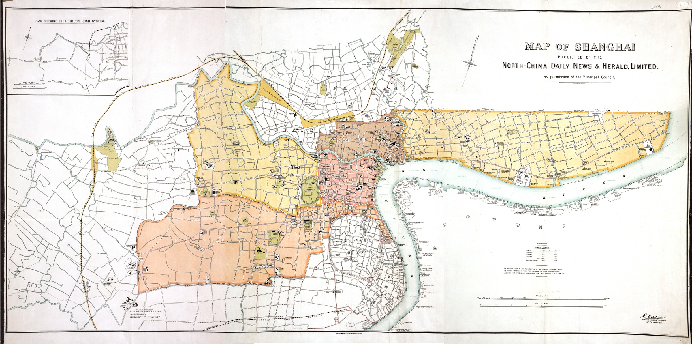
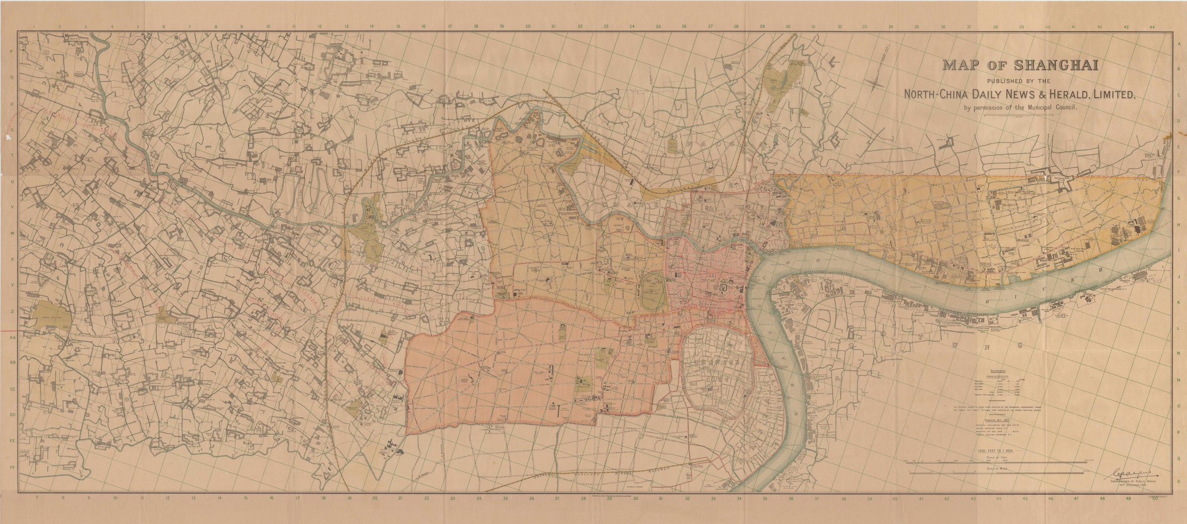
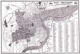
| 72 | Map of Shanghai | 1918 | | Map of Shanghai |
|

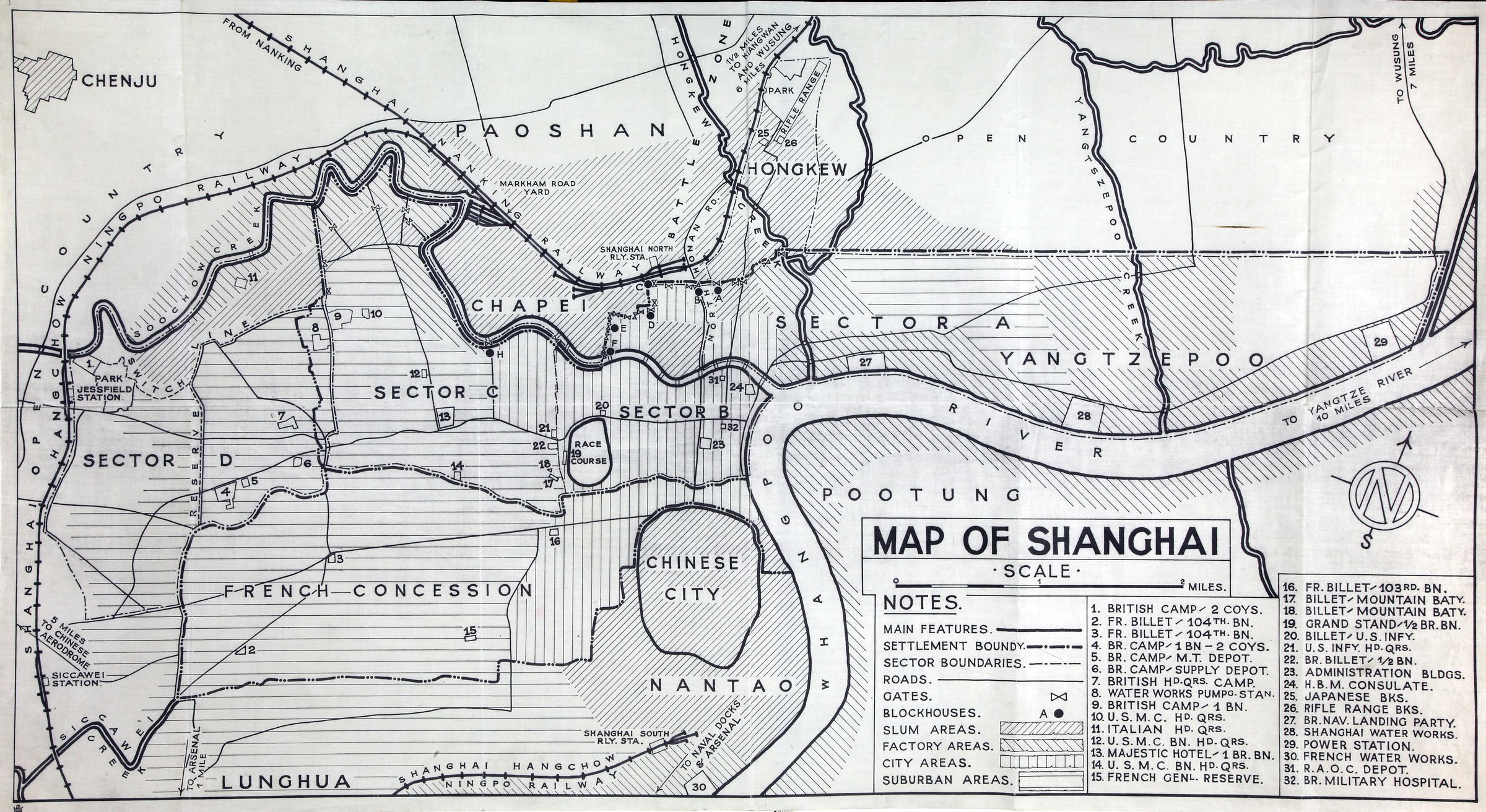
| 79 | Map of distribution of foreign forces and defences in Shanghai | 1935 | | Map of distribution of foreign forces and defences in Shanghai |
|
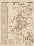
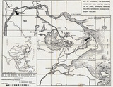
| 139 | Map showing Japanese-Chinese warfare now in Shanghai | 1932 | | |
|
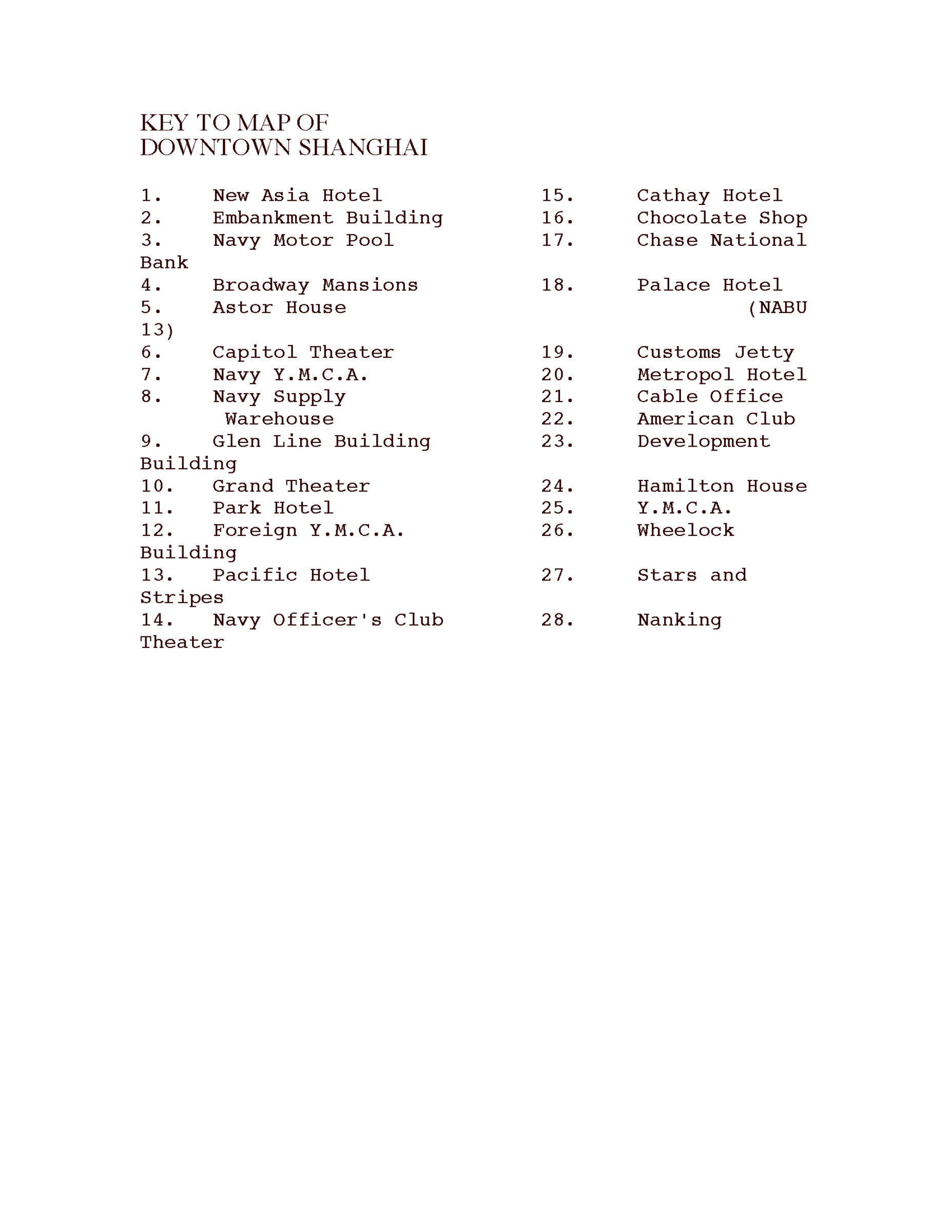
| 193 | Map of downtown Shanghai | 1945 | | |
|
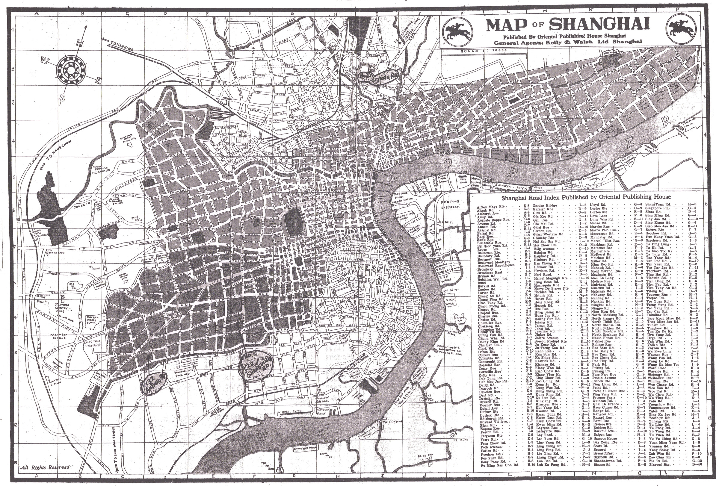
| 232 | Map of Shanghai : Supplement to "City directory of Shanghai" | | 1932? | |
|
| 234 | Map of Shanghai | 1913 | | |
|
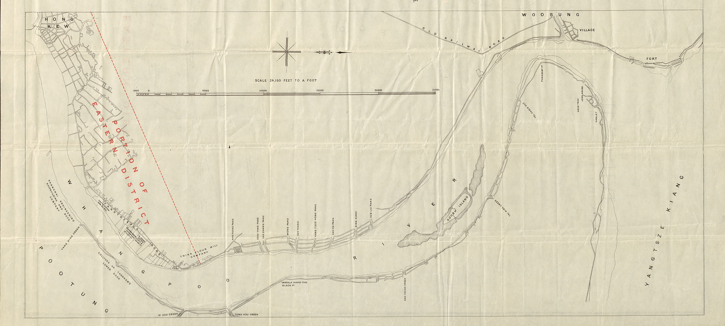
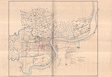
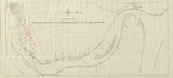
| 236 | Map of the Whangpoo and surrounding districts | 1923 | | (Huangpu jiang quan tu) |
|
| 247 | Map of Shanghai | | 1930-1939 | |
|
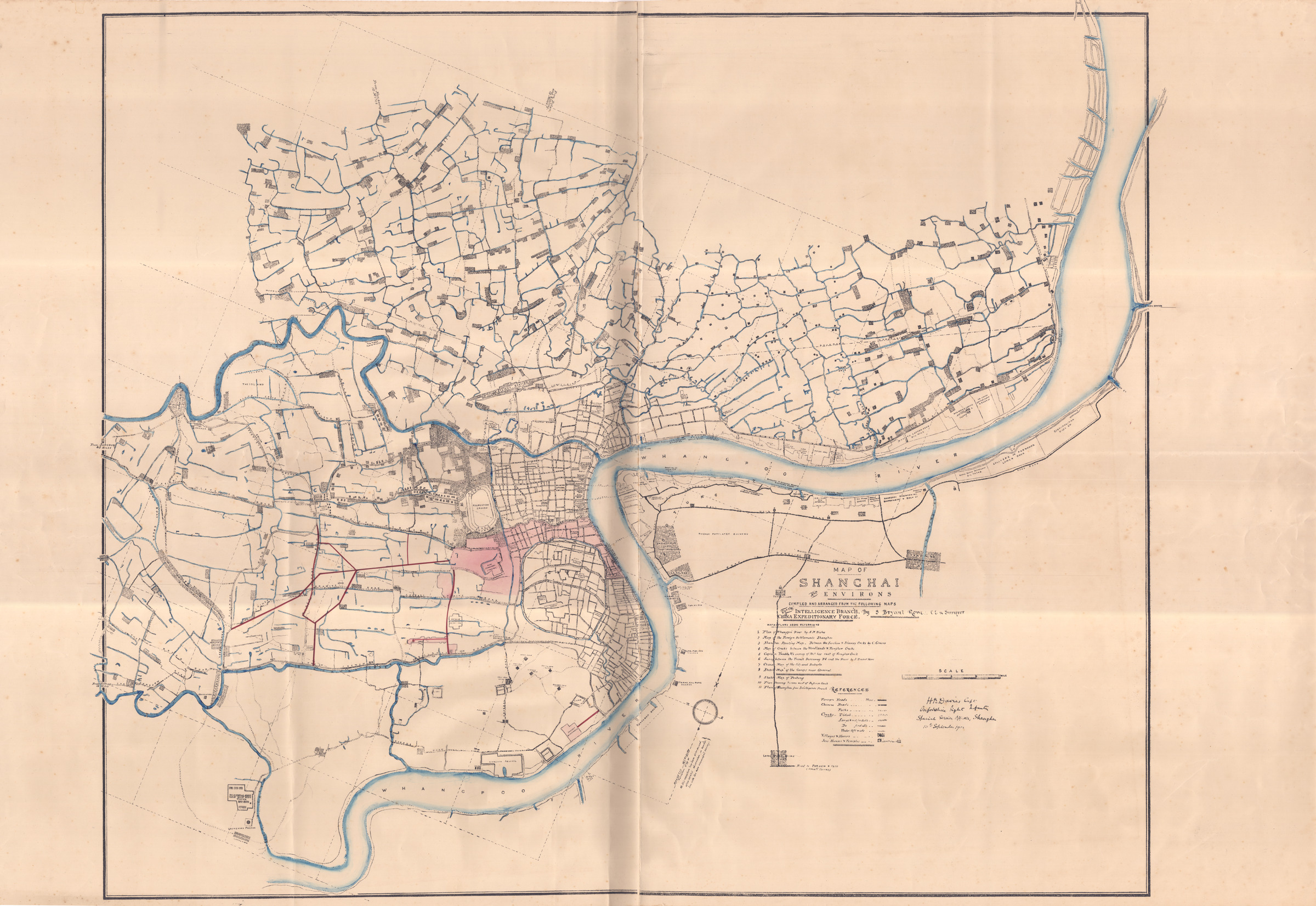
| 334 | Map of Shanghai and Environs | 1903 | | Map of Shanghai and Environs |
|

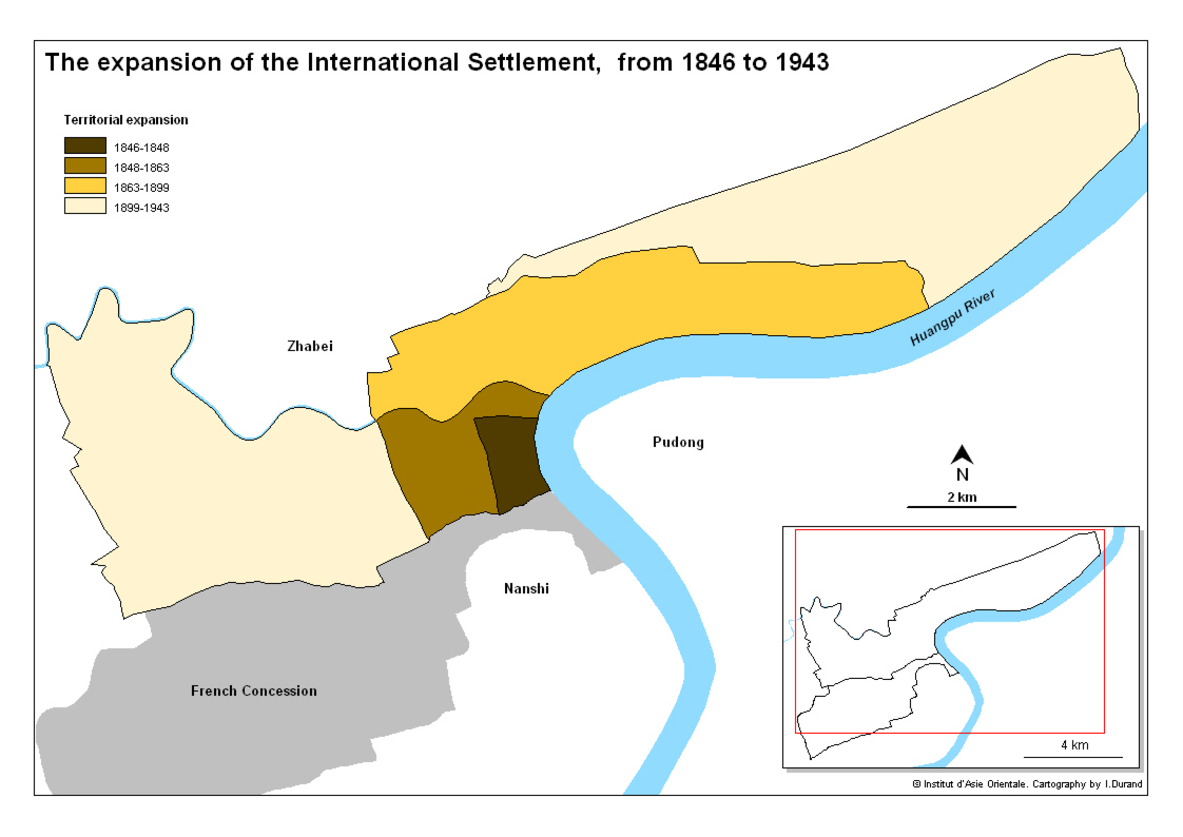
| 435 | Map of the expansion of the International Settlement (1846-1943) | 2008 | | Map of the expansion of the International Settlement (1846-1943) |
|

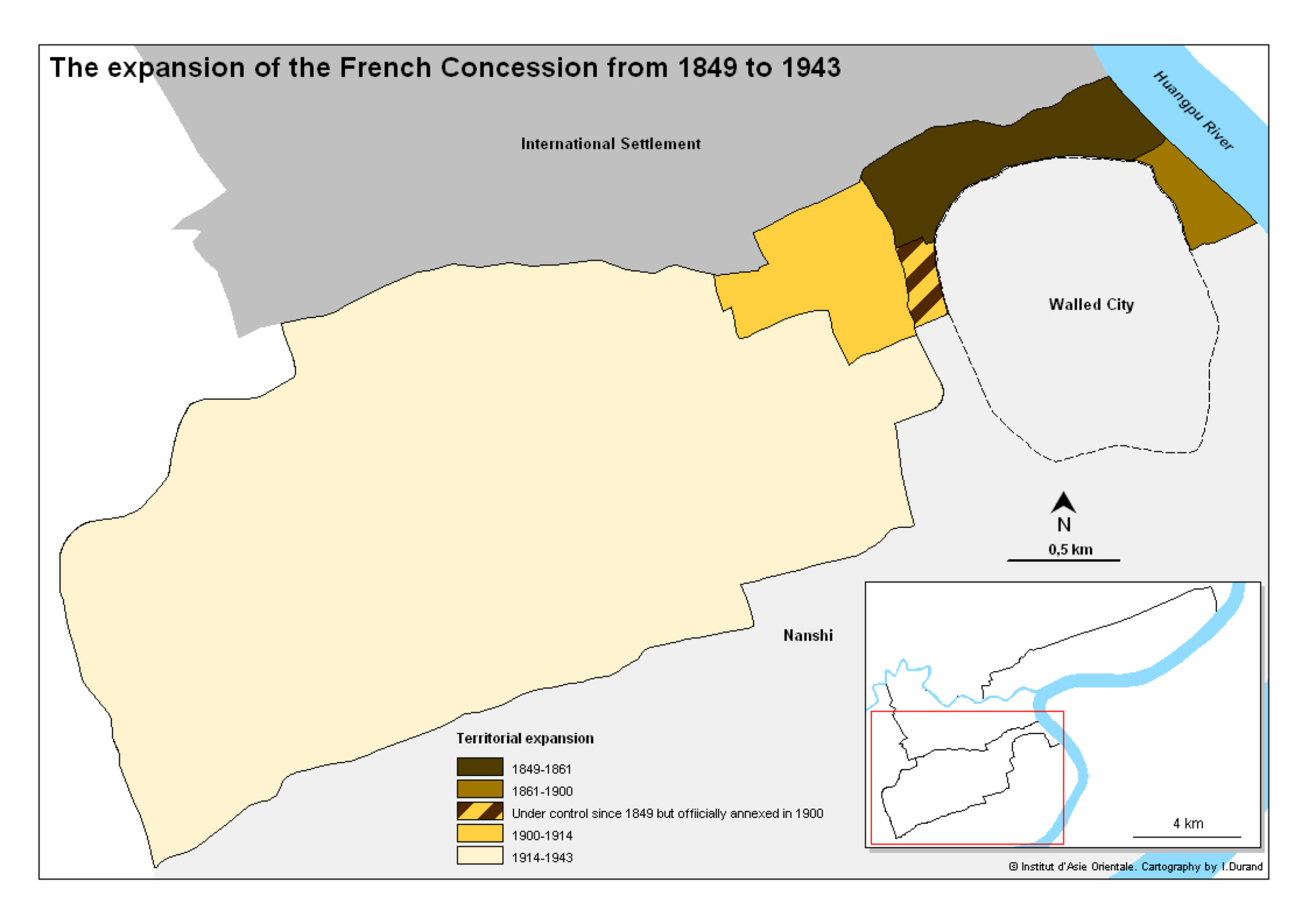
| 436 | Map of the expansion of the French Concession (1849-1943) | 2008 | | Map of the expansion of the French Concession (1849-1943) |
|
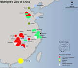
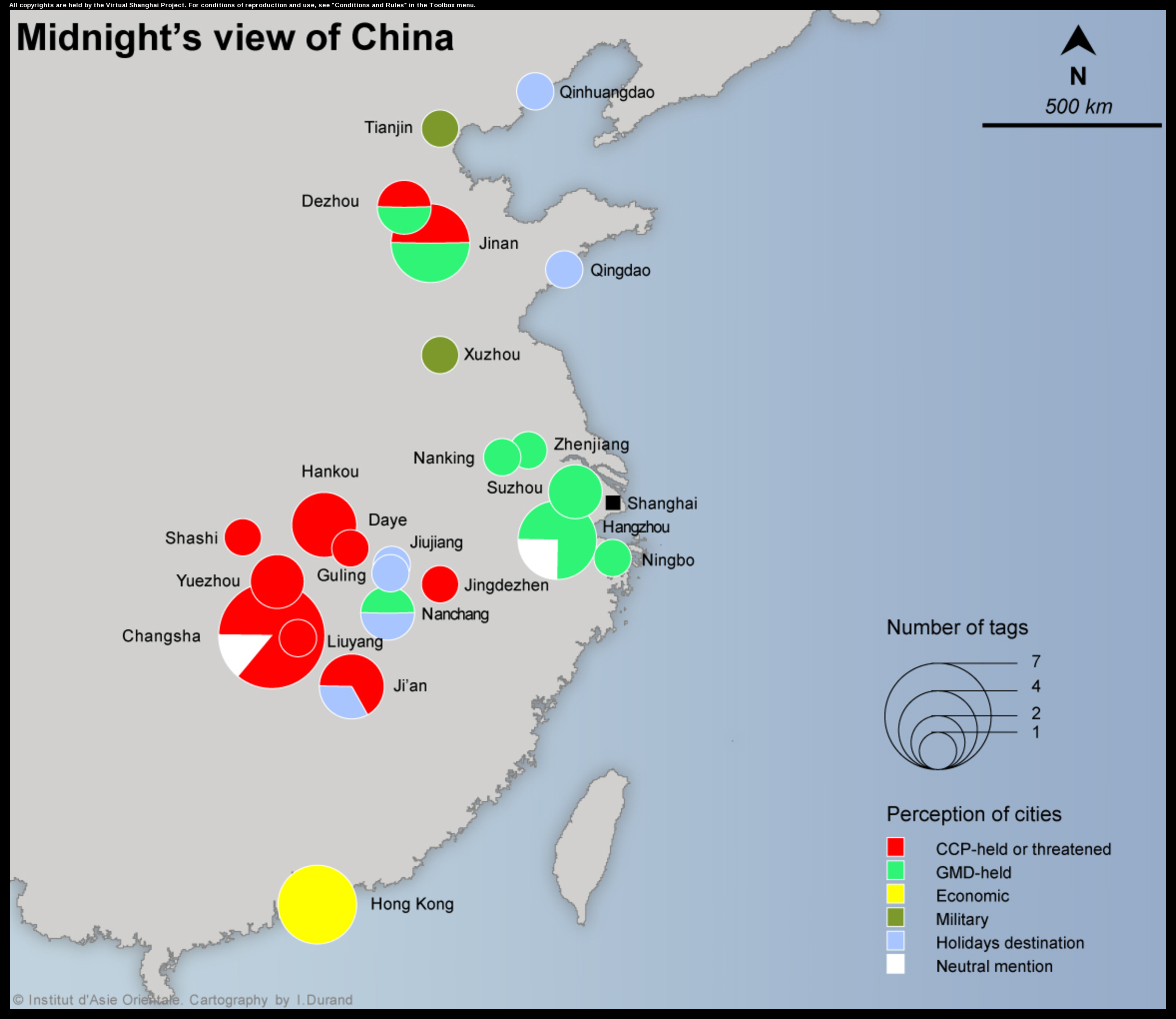
| 451 | Midnight's view of China (Mao Dun) | 2008 | | Midnight's view of China (Mao Dun) |
|
| 468 | Map of Shanghai | 1923 | | Map of Shanghai |
|
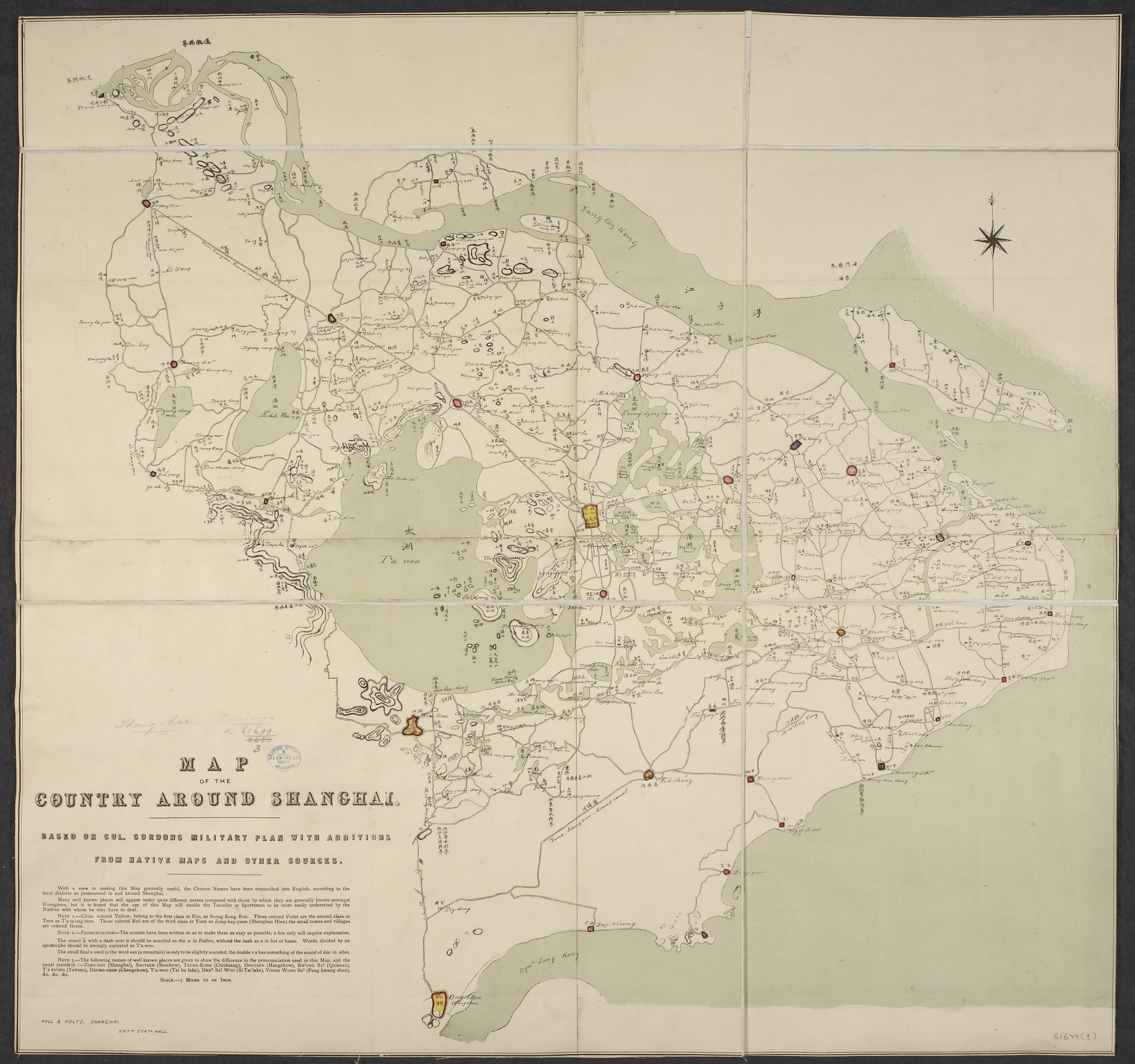
| 571 | Map of the country around Shanghai | 1864 | | Map of the country around Shanghai |
|
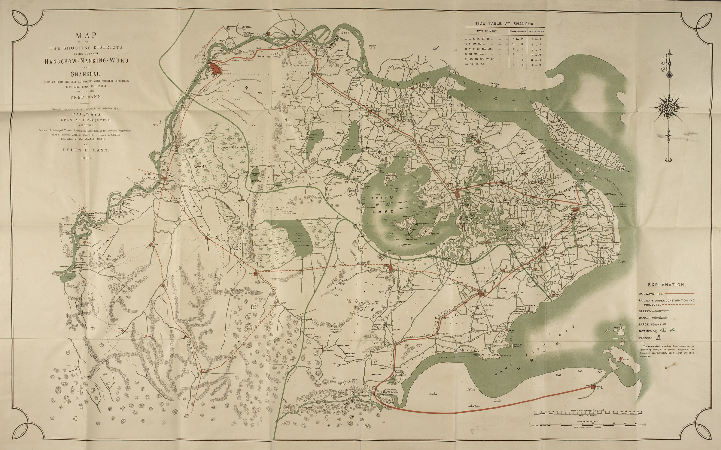
| 574 | Map of the shooting districts lying between Hangchow-Nanking-Wuhu and Shanghai | 1909 | | Map of the shooting districts lying between Hangchow-Nanking-Wuhu and Shanghai |
|
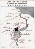
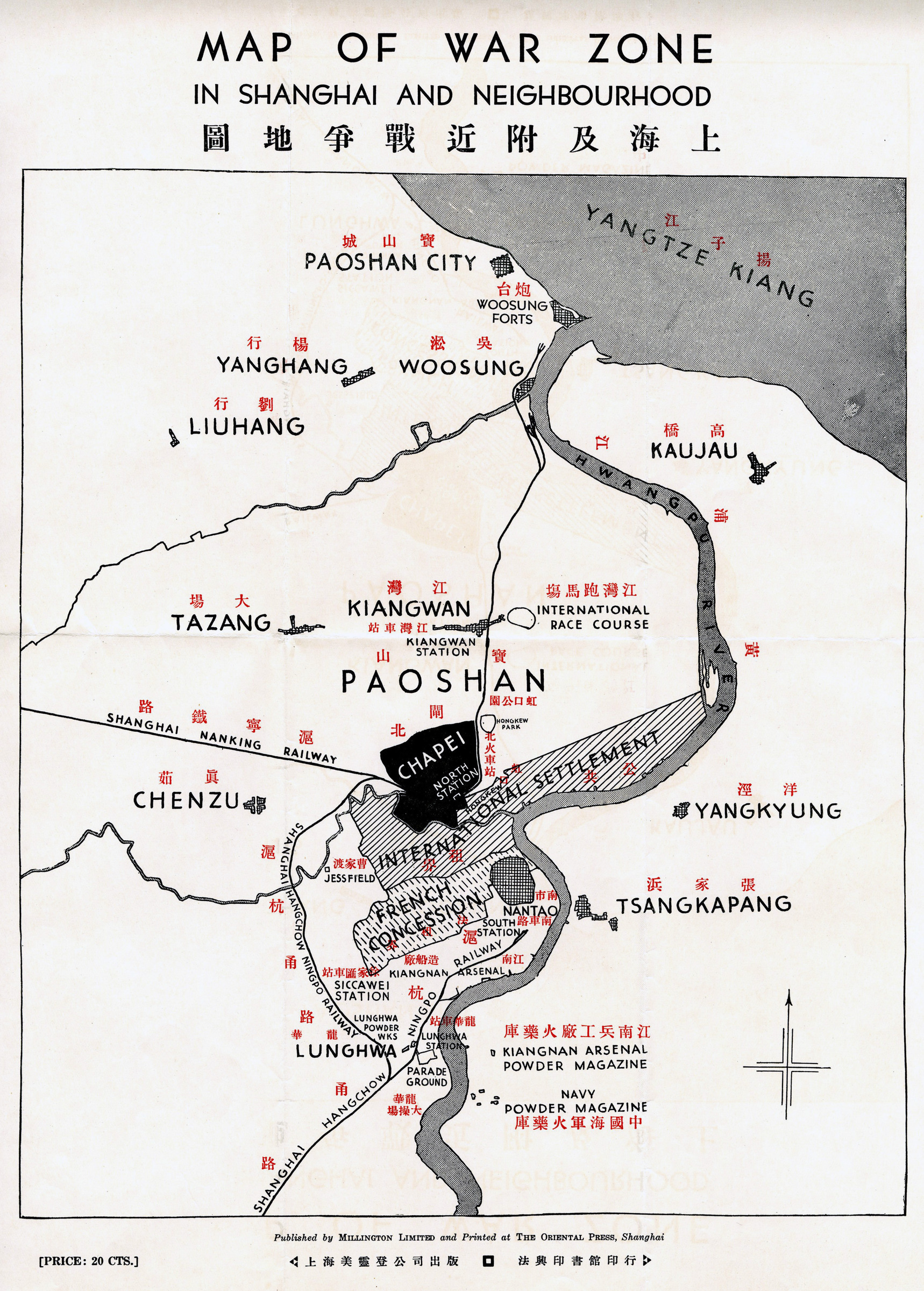
| 584 | Map of war zone in Shanghai and neighbourhood | 1932 | | Shanghai ji fujin zhanzheng ditu |
|

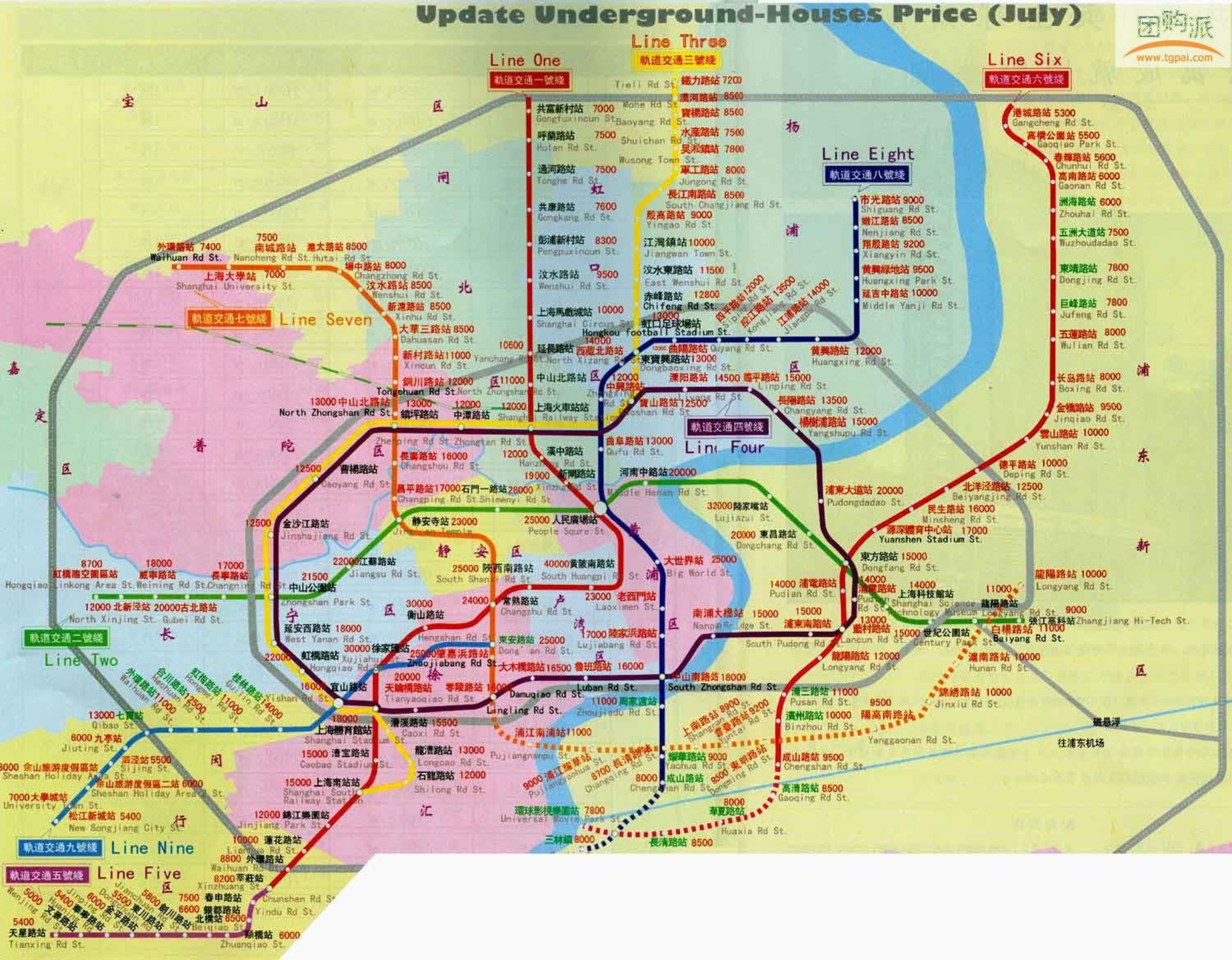
| 716 | Map of real estate values and subway system | 2006 | | Map of real estate values and subway system |
|
| 721 | Military map of the country around Shanghai from surveys made in 1862-65 | 1865 | | Military map of the country around Shanghai from surveys made in 1862-65 |
|
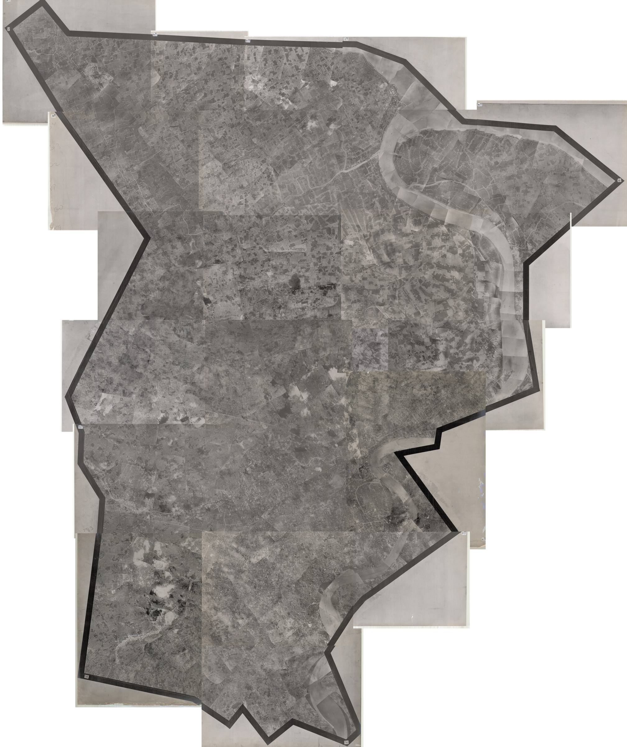
| 727 | Mosaic of Air Photographs of Shanghai taken between 28.7.1927 and 17.8.1927 | 1927 | | Mosaic of Air Photographs of Shanghai taken between 28.7.1927 and 17.8.1927 |
|
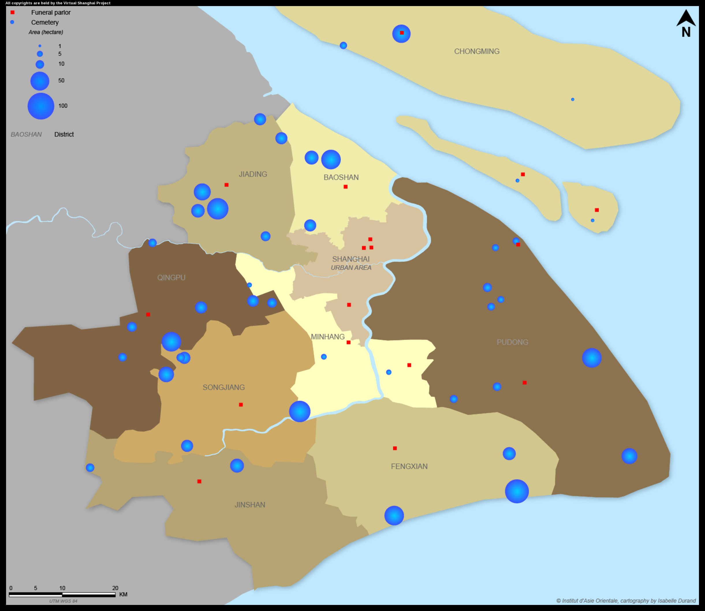
| 860 | Map of cemeteries and funeral parlors in Shanghai (2010) | 2010 | | Map of cemeteries and funeral parlor in Shanghai (2010) |
|
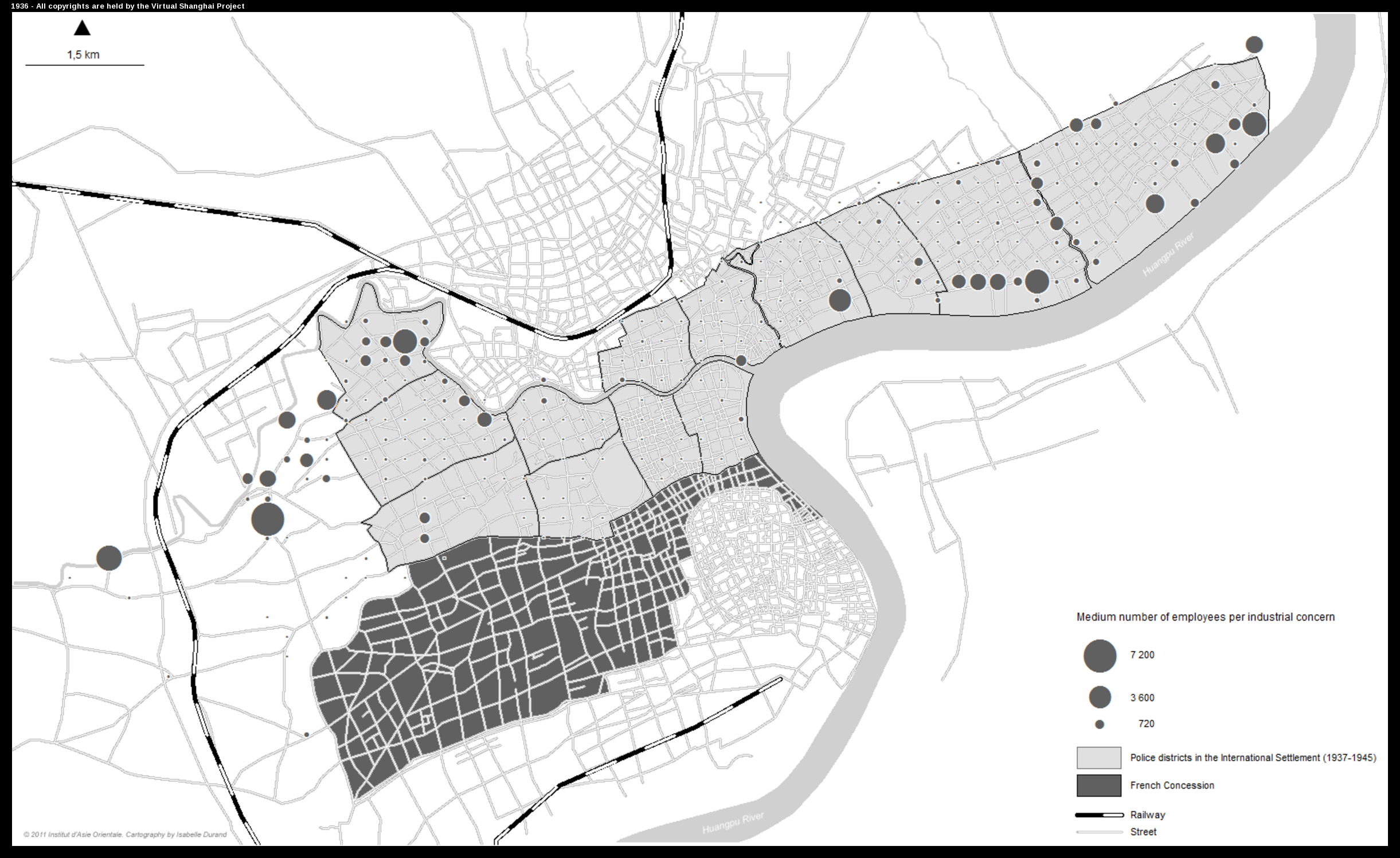
| 868 | Medium size of industrial concerns in the International Settlement (1936-1940): 250 meter-Grid | 2011 | | Medium size of industrial concerns in the International Settlement (1936-1940): 250 meter-Grid |
|
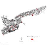
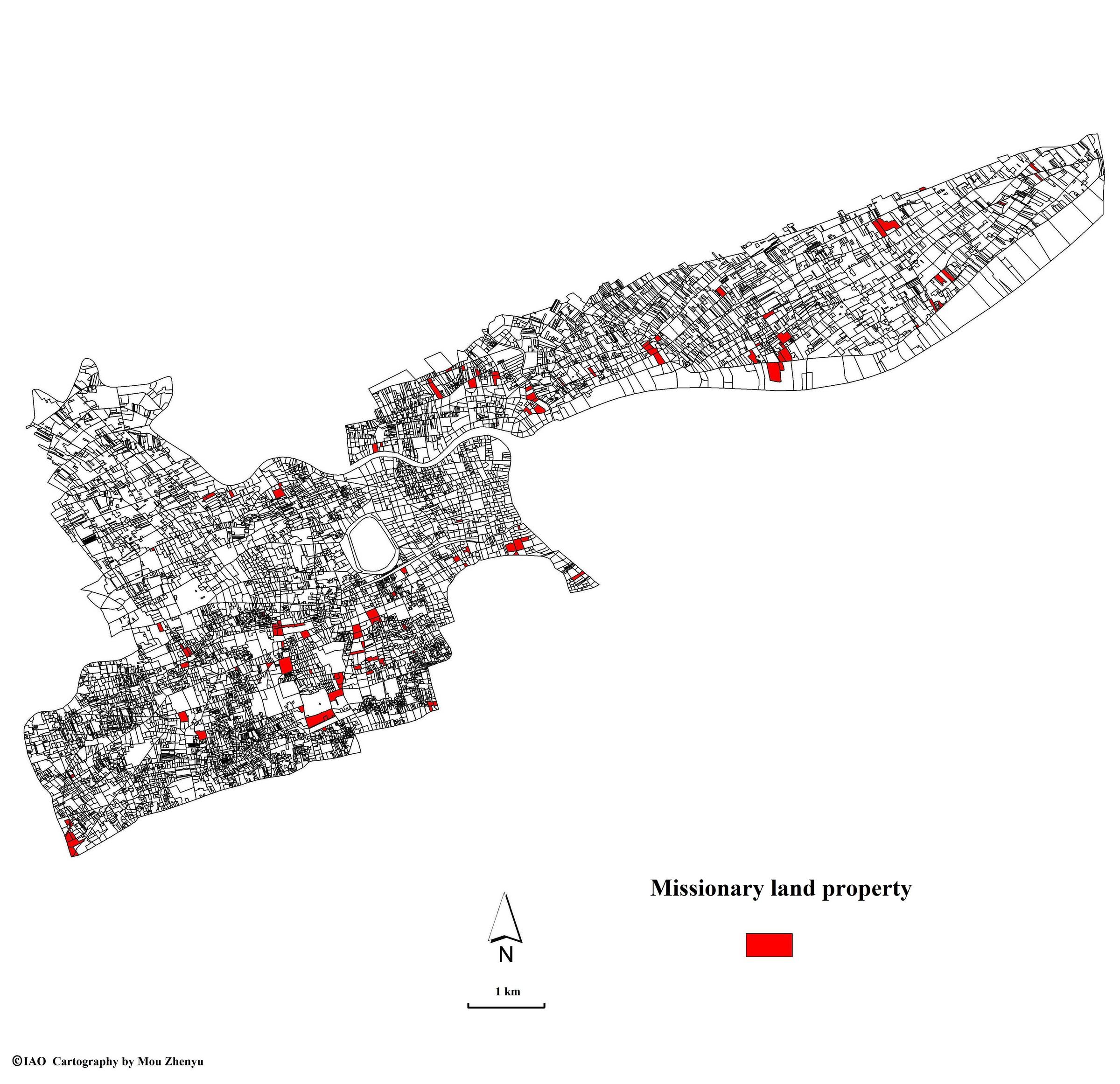
| 1654 | Missionary land properties(1933-1934) | | 1933-1934 | |
|
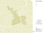
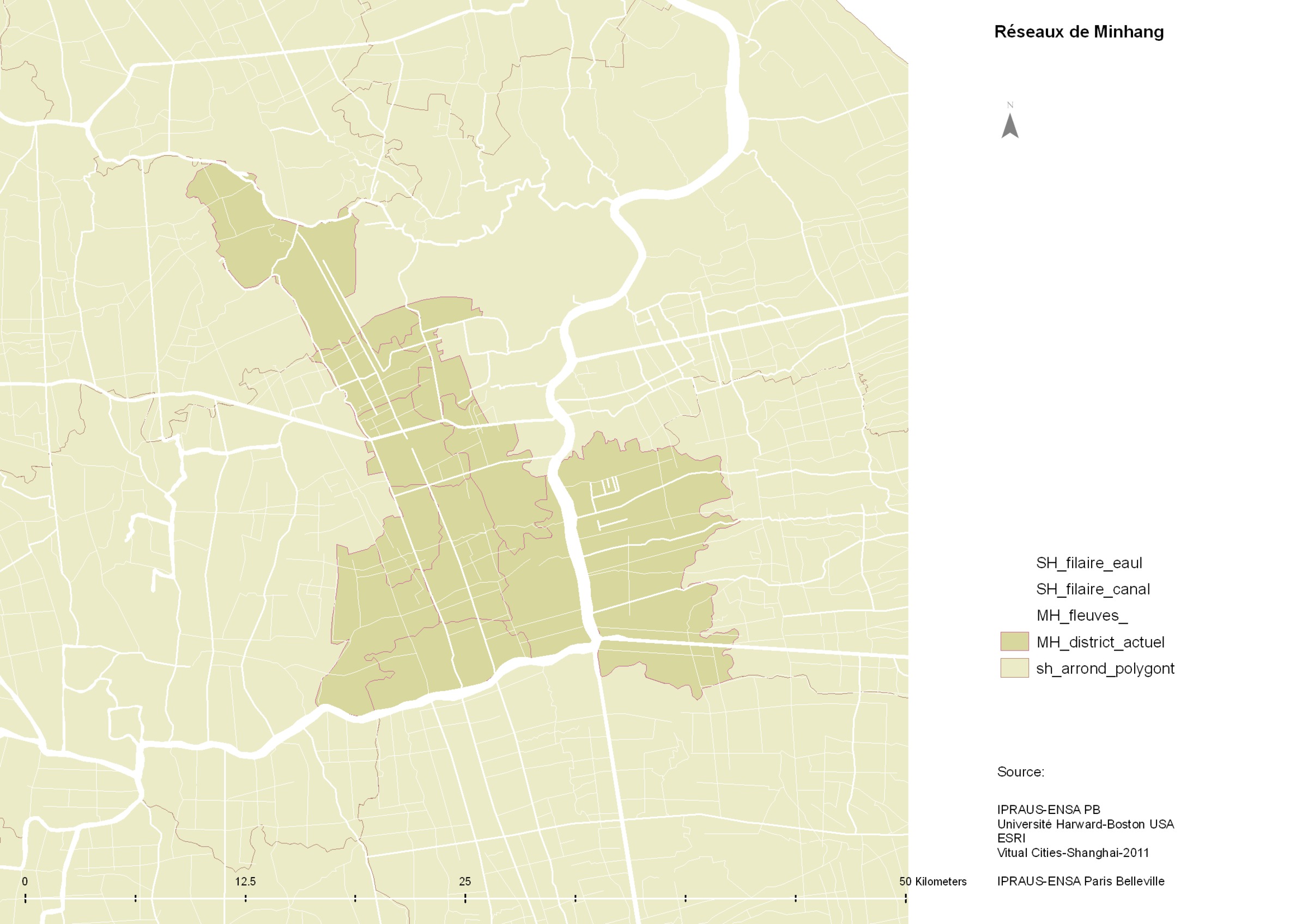
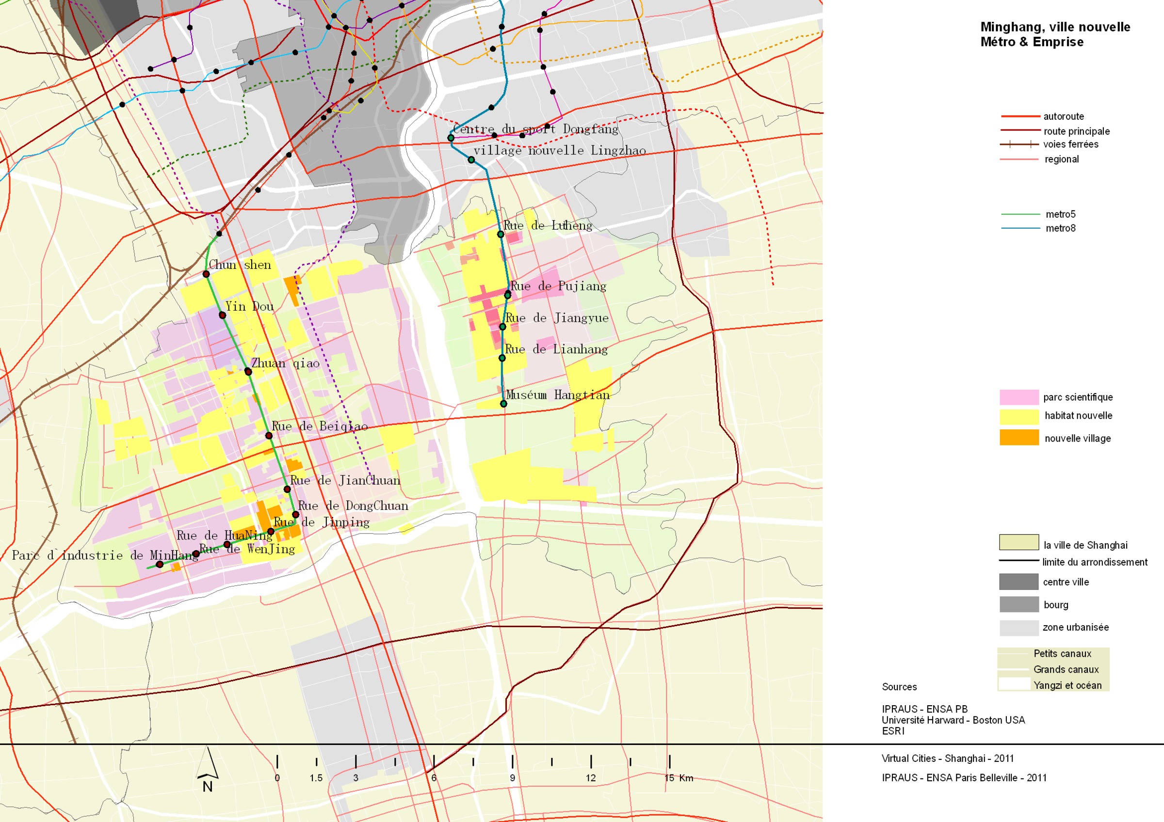
| 1675 | Minhang. limite administrative. | 2011 | | |
|
| 1686 | Minhang ouest. métro et occupation du sol | 2011 | | |
|
| 1689 | Minhang. occupation du sol | 2011 | | |
|

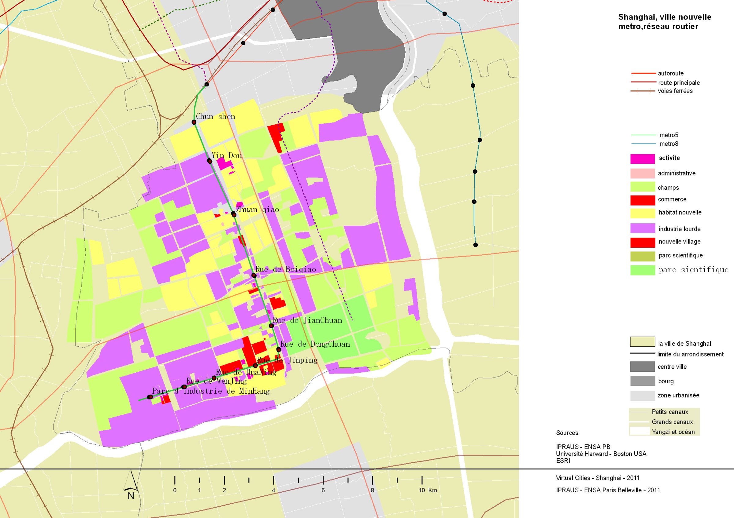
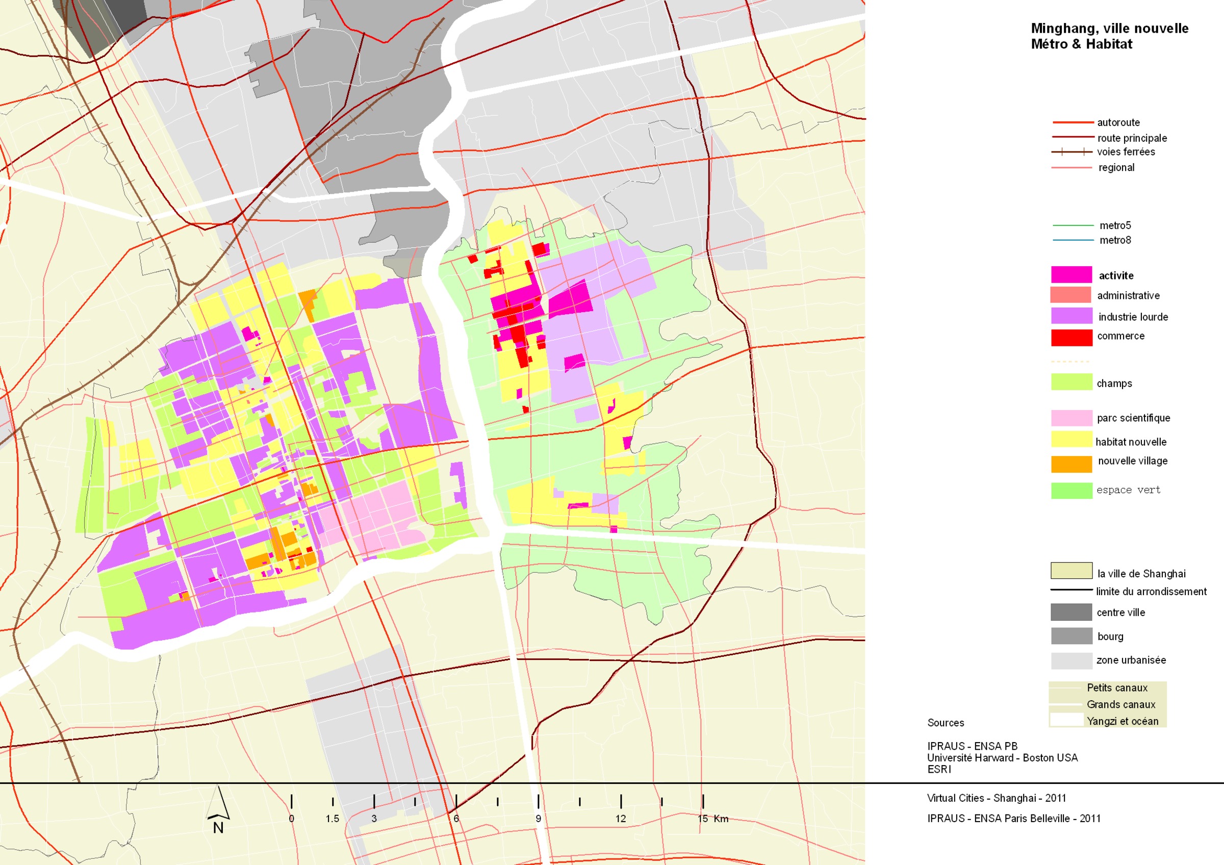
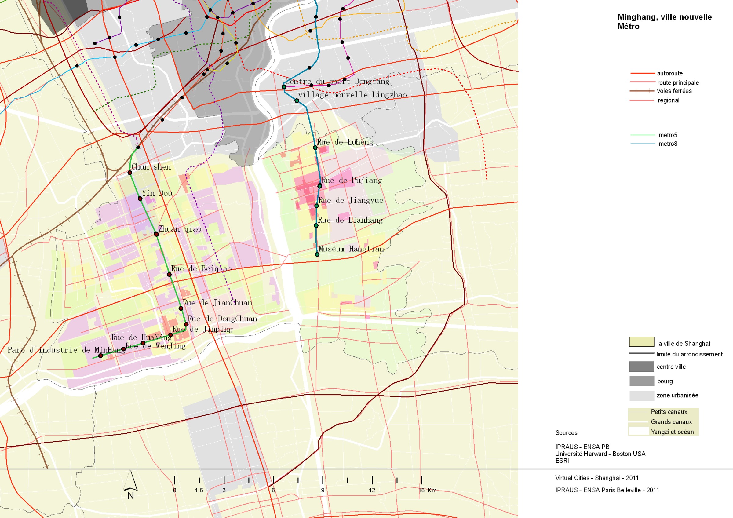
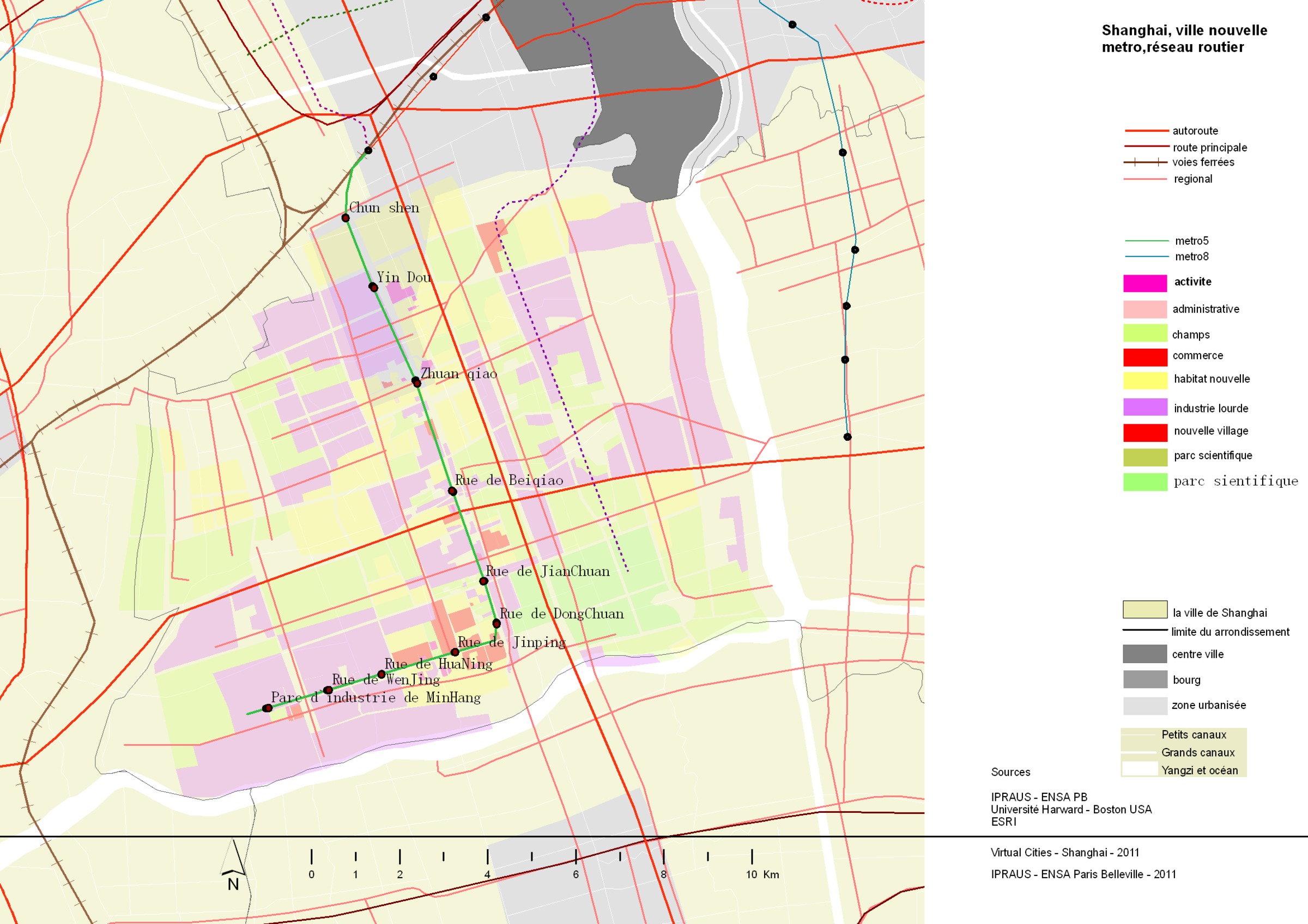
| 1705 | Minhang, métro et route | 2011 | | |
|

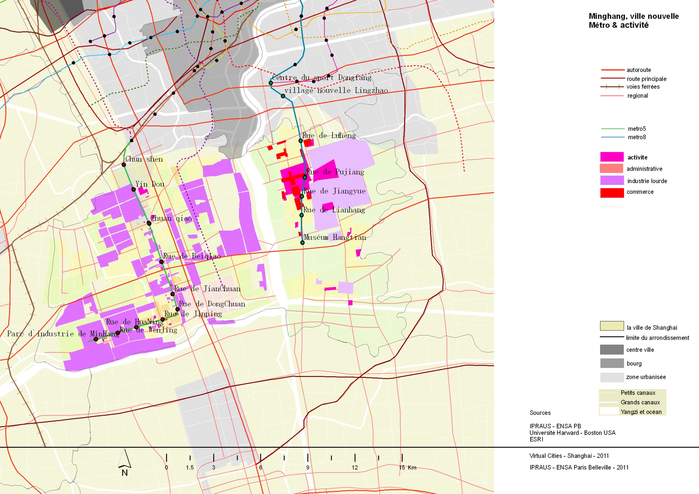
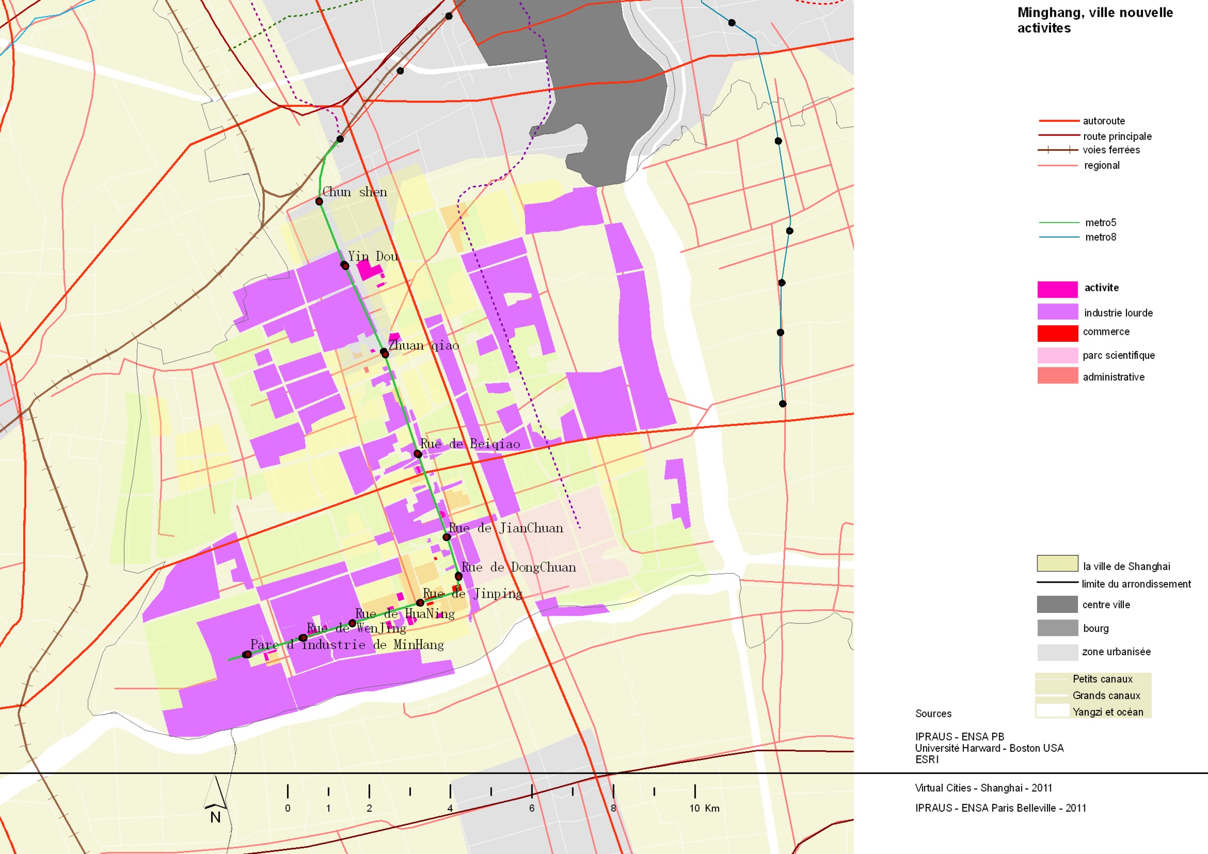
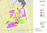
| 1706 | Minhang, activité, métro et route | 2011 | | |
|
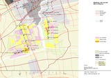
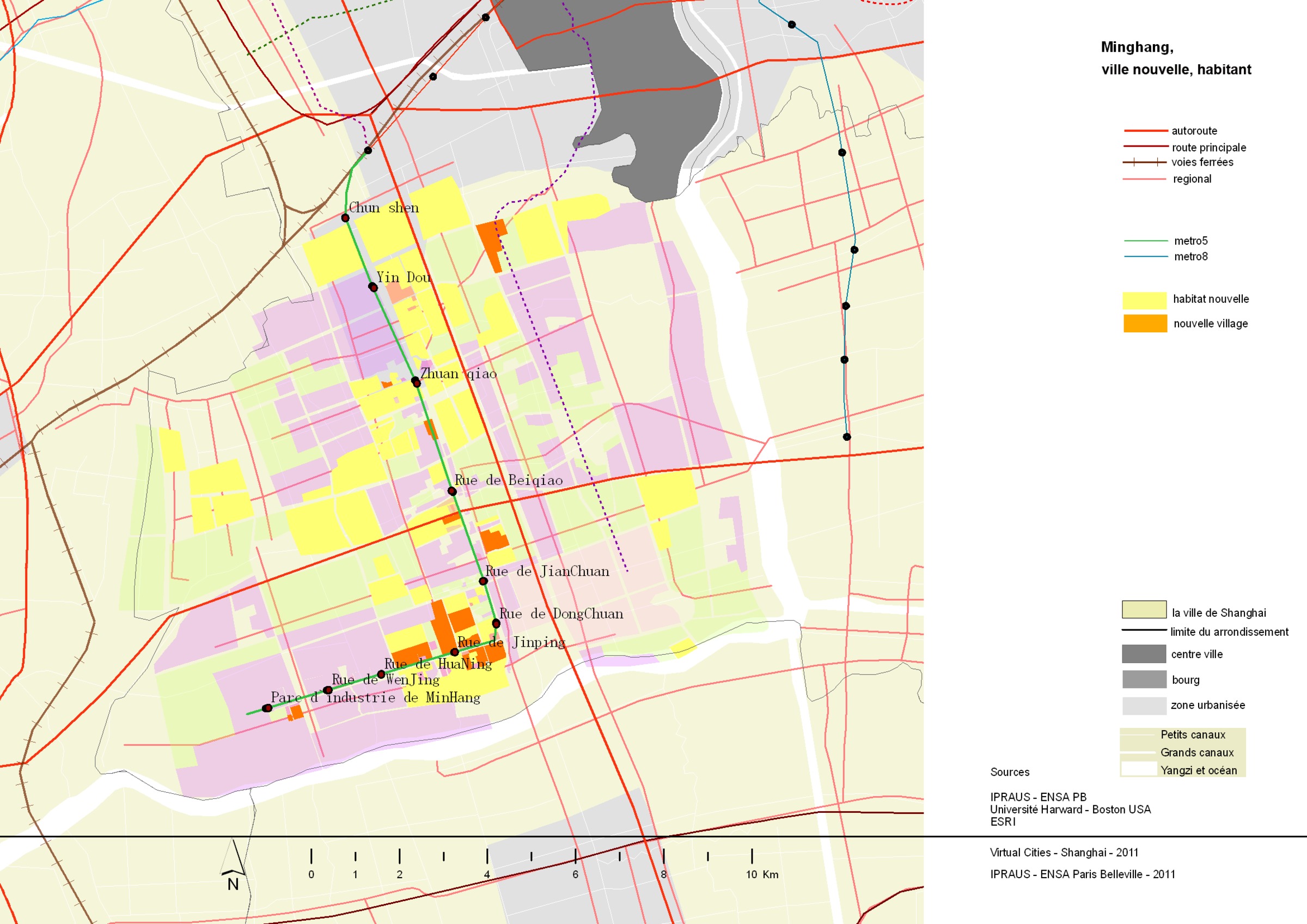
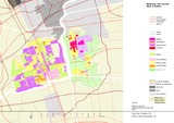
| 1707 | Minhang, habitat, métro et route | 2011 | | |
|
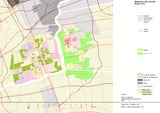
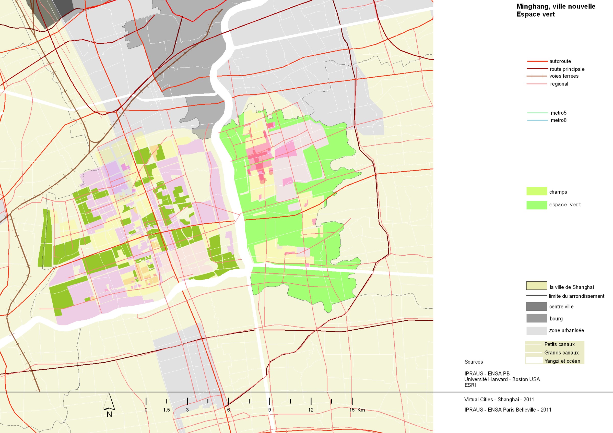
| 1708 | Minhang, espace vert | 2011 | | |
|
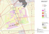
| 1709 | Minhang ouest, métro et route | 2011 | | |
|

| 1710 | Minhang ouest, habitat nouveau et ancien, métro, route | 2011 | | |
|

| 1711 | Minhang ouest, activité | 2011 | | |
|
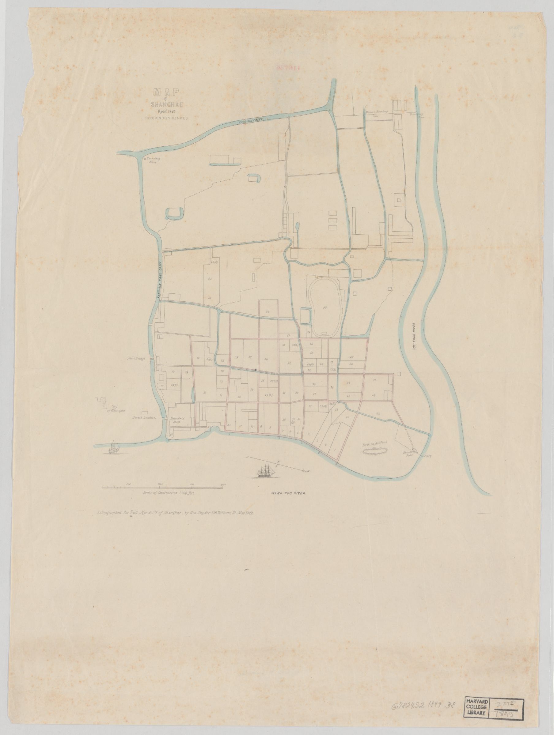
| 1851 | Map of Shanghae. April 1849 : foreign residences | 1849 | | |
|
| 1865 | Map of Shanghai, its environs, Hangchow bay, Yantse Mouth, Tai Hu Lake, Shanghai-Nanking Railway, Shanghai-Hangchow Railway | | | |
|
| 1897 | Map of the Huangpu River | | 1912-1927 | |
|

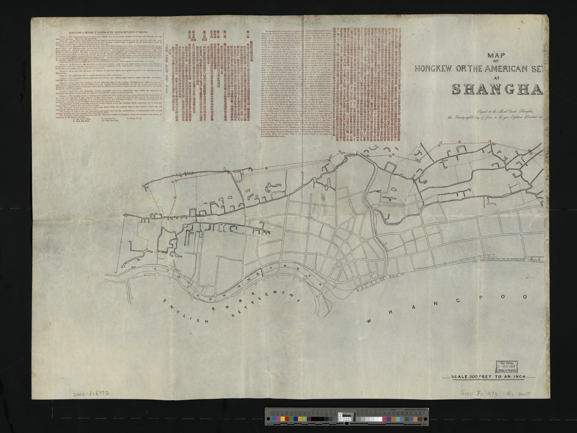
| 2007 | Map of Hongkew or the American Settlement at Shanghai | 1873 | | |
|
| 2058 | Map of Shanghai's main urban areas [Chinese - 中文] | | 1914-1943 | |
|