8 documents
return to data set


filter by Original title A B C D E F G H I J K L M N O P Q R S T U V W X Y Z [all]
| Document ID | Original title | Year | Year range | Transliteration | |
|---|---|---|---|---|---|
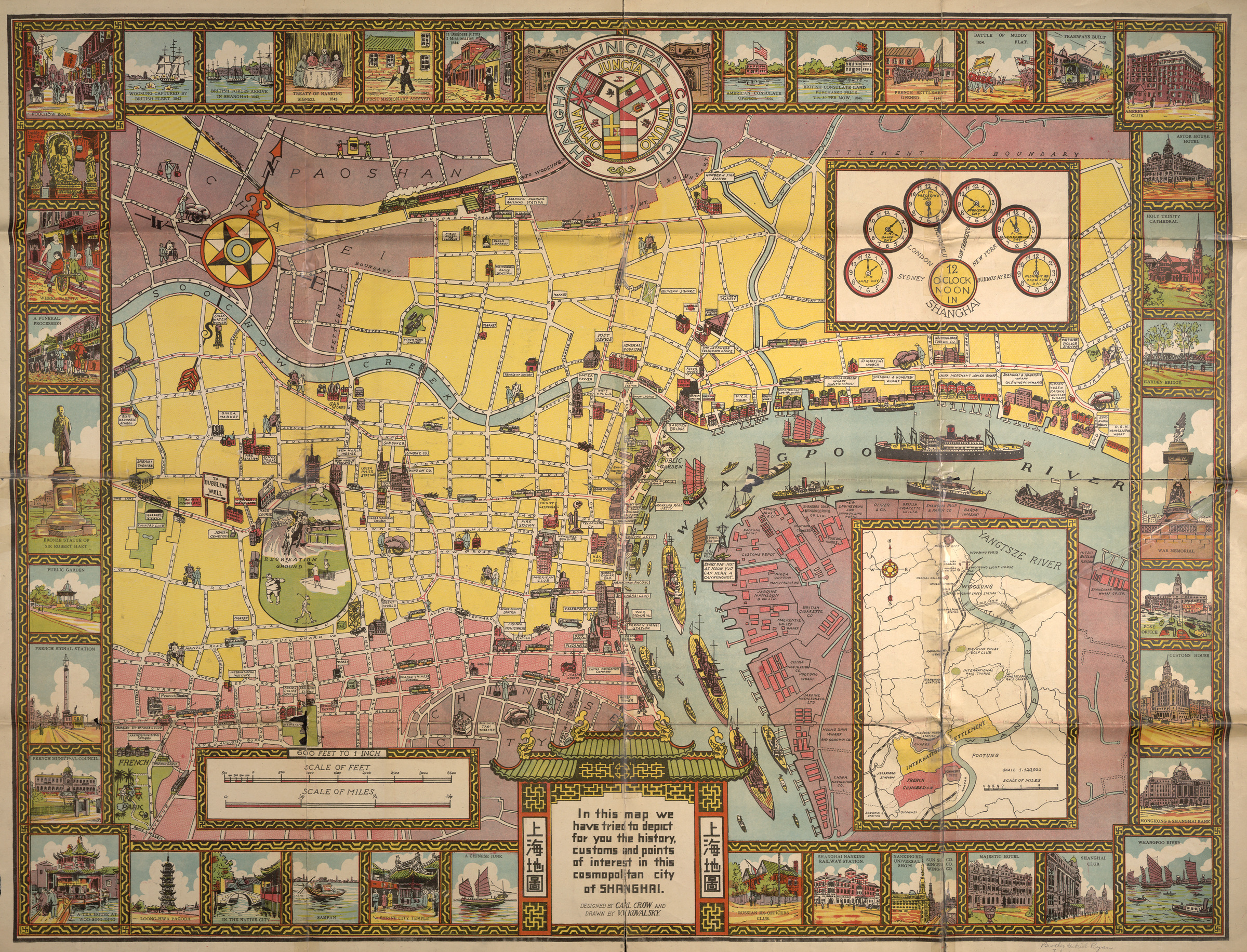 | 68 | Illustrated historical map of Shanghai | 1932 | Illustrated historical map of Shanghai | |
 | 274 | Initial position of Japanese and Chinese troops in August 1937 | 2006 | Initial position of Japanese and Chinese troops in August 1937 | |
 | 409 | Improvement of the Huangpu River for ocean navigation - State of river 1906 before regulation | 1919 | Improvement of the Huangpu River for ocean navigation - State of river 1906 before regulation | |
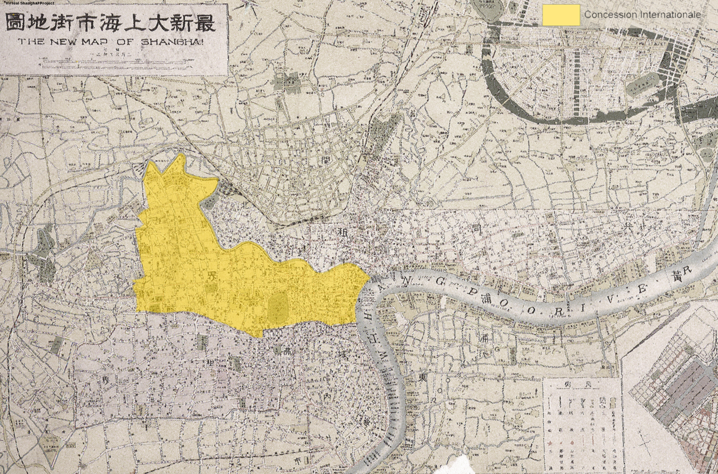 | 705 | International Settlement: Central and Western Districts | 2009 | International Settlement: Central and Western Districts | |
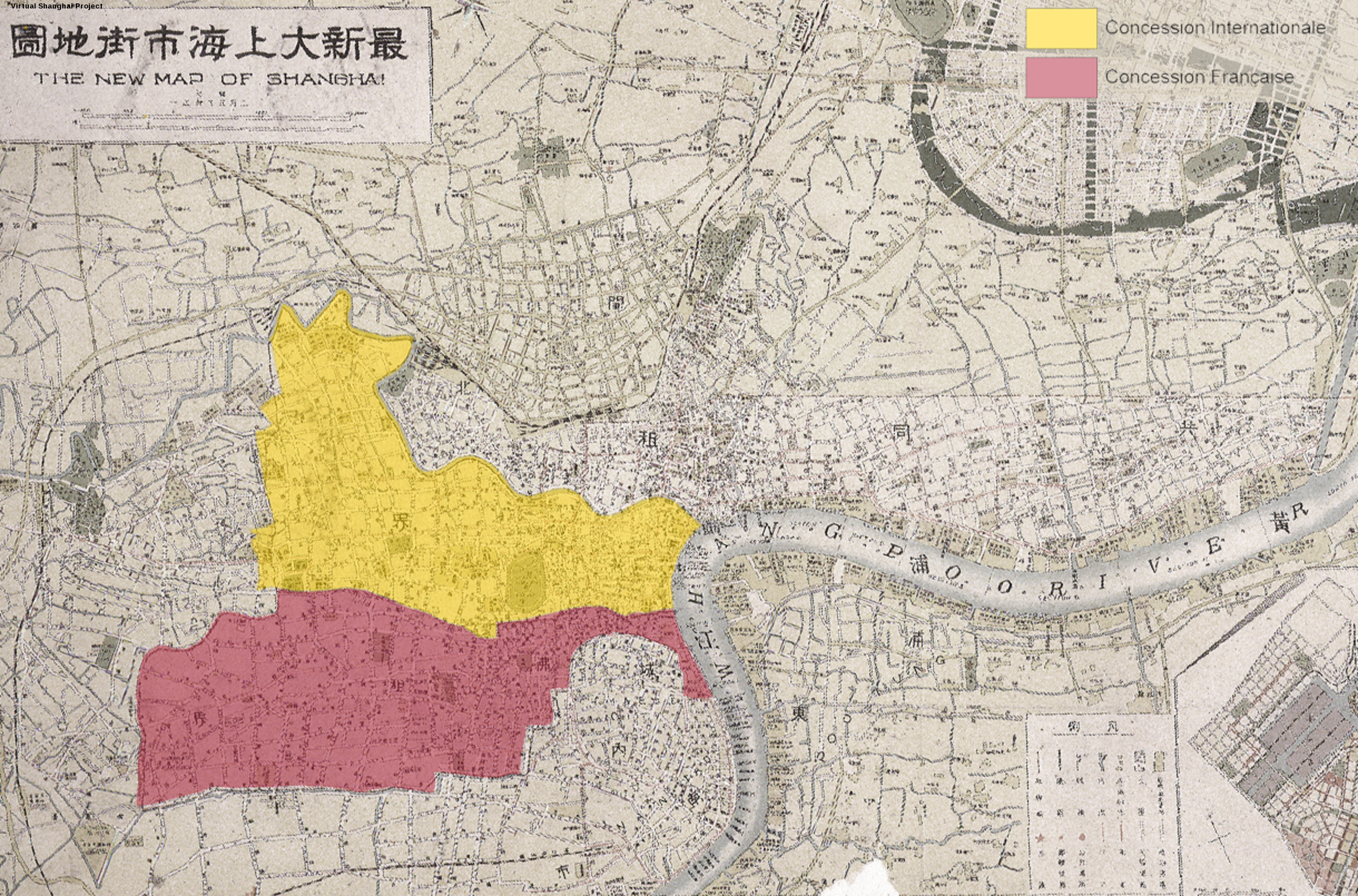 | 706 | International Settlement (central & western districts) and French Concession | 2009 | International Settlement (central & western districts) and French Concession | |
 | 708 | International Settlement, French Concession, & Nanshi (full) | 2009 | This map is part of a series meant to introduce the place of Zhabei in the city in relation with the wars that affected it in the course of the Nanking decade. | |
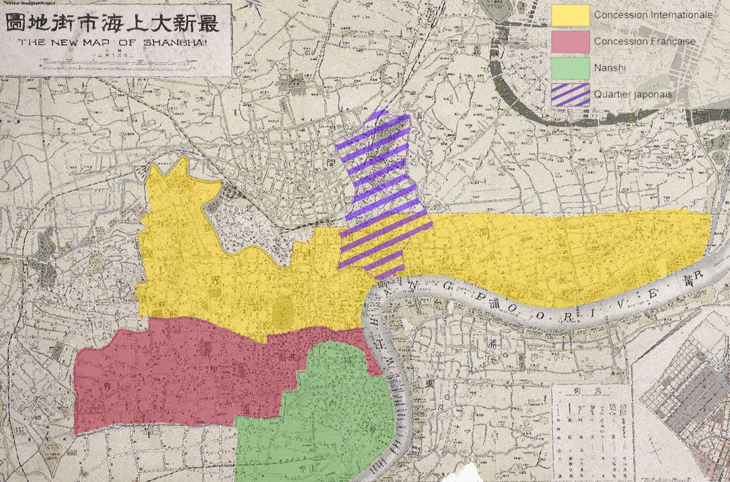 | 709 | International Settlement, French Concession, Nanshi & Hongkou | 2009 | International Settlement, French Concession, Nanshi & Hongkou | |
 | 710 | International Settlement, French Concession, Nanshi, Hongkou & Zhabei | 2009 | International Settlement, French Concession, Nanshi, Hongkou & Zhabei | |
© 2003-2021 IrAsia - Projet Director: Pr. Christian Henriot
Site created by Gérald Foliot with webActors - Hosted by TGIR Huma-num
The site is part of the Virtual Cities Project: Beijing - Hankou - Saigon - Shanghai - Suzhou - Tianjin - Wenzhou - Zhejiang
Select language : English | 简体字 | 繁體字
Site created by Gérald Foliot with webActors - Hosted by TGIR Huma-num
The site is part of the Virtual Cities Project: Beijing - Hankou - Saigon - Shanghai - Suzhou - Tianjin - Wenzhou - Zhejiang
Select language : English | 简体字 | 繁體字
![]()
![]()
Page rendering in 0.017s